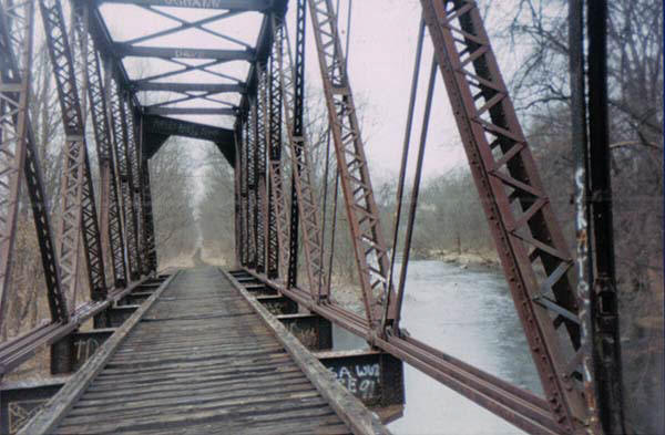
Pin truss bridge - Washingtonville
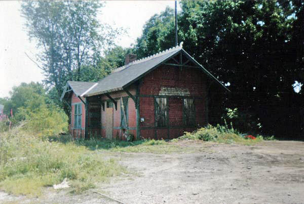
Leaving Washingtonville, I could just picture this scene from the rear of the lat passenger car or caboose of the local way freight, the rails playing out underneath. Only a decade would change this scene forever. The station surviving fire, vandalism, and even the death of Mr. McLaughlin before the town had to finally step in for safety sake. Just ahead the line crosses Rt. 208. A marker now marks the site of the Erie Railroad even as development encroaches around it.
Rt. 208 crossing, summer of ‘81
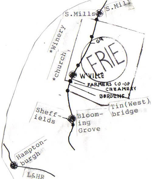
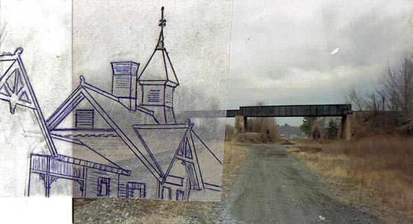
Past the crossing we “rumble” over another Moodna Crossing coming up to crossing Rt. 94. On the left there where School buses now park was once where milk cars were set out under the shadow of the chimney that had the name “BORDENS” built into it. A mile past 94 and we cross what was once known as “Tin Bridge” because of the original wooden bridge being clad in tin as a fire measure.
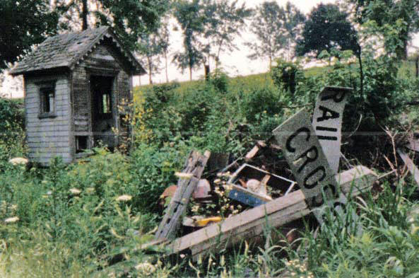
About a mile ahead of Tin bridge we cross what was once the site of Blooming Grove station and Sheffield’s Creamery. Nothing here to mark what was once here now except a railroader’s memories. Here too, is where the story gets a little strange. On every trip I took out here that brought me through this section I was always glad to get back to tin bridge (see Icabod Crane) and never understood why. Then after the book was out, and without brining the subject up, people started giving me their stories of the area. I started hearing stories about “something” being out there……
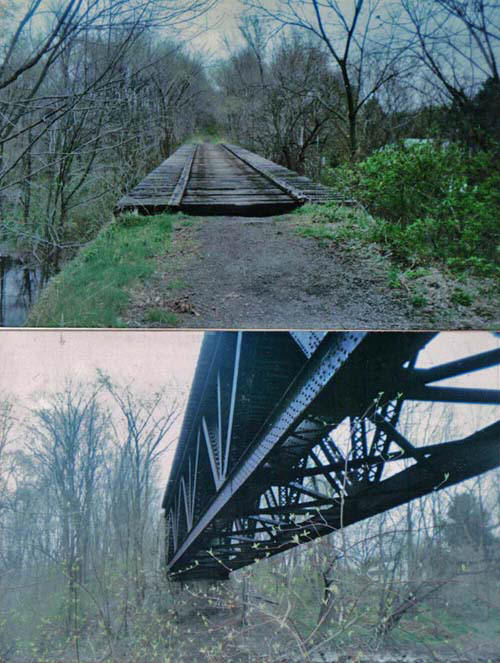
Tin bridge - You can’t make this stuff up!
Crossing over Rt. 94 we approach Craigville and aptly named Hardscrabble road, near the site of the Craigville station. In between here and the RT. 94 crossing the line passes through a series of rock cuts that explain why nineteen miles of track took thirteen years to finish!
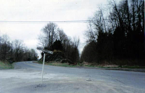
Hardscrabble crossing. (rails still in road-’91) Craigville station stood behind here And to the left. Another railroad site that time has not been kind too.
Ahead lies another rock cut and a straight run into the wye at Greycourt. Pass over Cromline Creek and we are into what was once the wye and the connection with the Erie mainline. The water tower stood in the wye. Up ahead to the right stood a classic Gingerbread style station.
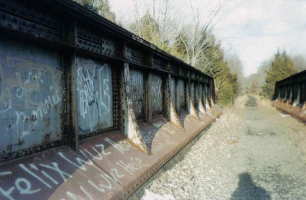
Cromline creek crossings
Drawing and picture, author’s collection
Site of Greycourt station. The Erie mainline was to the right and is now a rail trail. Here also lies another mystery. In the corner of the platform, I have been told, there was a stone with the name ERIE carved into it. I have been asked about the fate of the stone but have no clue. Does anybody out there have any ideas?
I want to conclude with a collection of railroad stations. Some still here, some no longer with us:
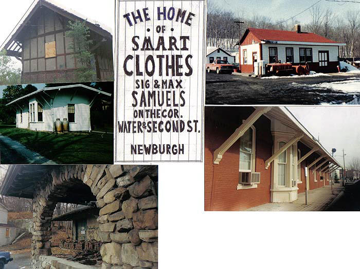
Clockwise from upper right: Enderlin on the Newburgh Short cut, now CornwalL coal and supply.
Goshen station on the former Erie Mainline.
Chester station on the former Erie main, now beautifully restored and on the rail trail.
Mountainville station on the short cut. Still standing and Once a library.
Harriman station on the former mainline, recently demolished.
In the center is a handmade copy of an advertisement that once hung on many Erie stations.
I recall a part of an article written on the 25th anniversary of the closing of the NYOW railway that still rings true today, maybe even more so:
..When the oil wells go dry, will we find a replacement, will cars be practical with a dollar a gallon gas rationing? Look at the weed- strewn right of way where the O&W trains once ran-and think hard….